Architect
Haslov and Kjaersgaard Planners and Architects
Type of Area
Bay
Land/water interaction
Riprap
Sandy beach
Sand dunes
Built Environment Types
Low built
High green
Scale of Impact
District/ neighbourhood
City
Regional
Intervention Scale (Spatial)
Linear development – multiple interventions
Project Types
Urban waterfront development
Outdoor Recreation
Sports facility
Urban/ Rural
Inner urban area
Visibility and Openness
Partly open
Partly enclosed
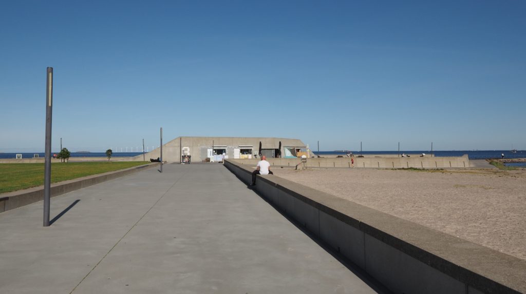
A New City Beach
This project was completed in 2005 and designed by the firm of Haslov and Kjaersgaard Planners and Architects on an artificial island next to the coastline in the Copenhagen district of Amager. The site is a large-scale landscape which provides a contrast to the density of the rest of the Copenhagen waterfront where an open sky and wide horizon offer special experiences.
The first ideas for this project emerged in the early 1980s from local grassroots organisations and other stakeholders. People involved in promoting the project wanted to ensure that openness would be the main quality in the area, and the edge of the existing beach was to be moved further out to form a better one. This was achieved by creating a 2 km-long artificial island which is separated from the original beach by a lagoon which is crossed by three bridges.
The beach is organized into two sections. The northern section comprises a natural beach environment of winding paths, broad sandy beaches and low dunes. The southern section is the so-called city beach where there is a wide promenade and areas for playing games or picnicking. At the southern end there is a small marina and car parking. The lagoon has shallow, sheltered areas safe for children and a 1,000 m swimming course.
The architectural structure focuses on the meeting between the linear coastal road and the building lines in the flat landscape of the island of Amager and the new coastline. Long sight lines run through the beach park. The coastline is laid out to take account of the dynamics of wind, waves and currents. There are focal points: the point at the extreme east (that governs the main orientation of the two beaches) and the two jetties to the north and the south. The “beach stations” – have a special character to help to create the sense of place. They follow the lines of the landscape and form artificial cliffs for people to walk on and around.
Perception and Meaning
Imageability
Accessibility
Sense of place
Health and Wellbeing
Increased physical activities
Place affordance
Sense of being away
Restorativeness
Interaction with Water
Visual
Tactile – fully in water
Website of the project:
http://www.hogk.dk/projekter/klimasikring/amager-beachpark-2003-2014/ [Danish]
Google map reference
The ratings for this project scores very highly for accessibility in all aspects. The design quality is also rated highly apart from the lack of reference to cultural heritage which, given its origins as a new landscape is no surprise. It scores very well for facilities apart from the lack of shade across the site. It also has high scores for health and well-being. It is also rated very highly for water connection and activities, with a little lower score for formal sports. An all-round excellent example which showcases the high reputation of Scandinavian landscape architecture.