
The BlueHealth Behavioural Assessment Tool (BBAT) has been designed to capture the activities that people take part in, at a particular blue space.
The tool employs non-participatory direct observation (i.e. behavioural mapping). We have transformed the usual paper-based momentary time sampling method of mapping into a geographical information system (GIS) software-based approach, using portable devices. This makes for a much more efficient process and considerably increases the potential for subsequent analysis of the data collected.
The exact location, type of activity and basic demographic characteristics of the users of the area are all recorded during systematic on-site observations. Weather and time variables are also recorded (including day/week/season).
The collected data can reveal the more popular and the less -frequented locations within an overall space and helps to identify differences in the spatial distribution of activities moderated by social, weather and time variables. Repeated observations before and after changes are made to a site, as was done at the Teat’s Hill intervention, enable monitoring of changes in usage patterns in a given space, allow us to assess design success and, potentially, to estimate the return on investment.
Access the BBAT
To use the BBAT you will need the QGIS software. This Open Source software is free to use. The tool itself was developed using QGIS version 2.8.17. It should run without problems in the latest stable version.
Before starting, please download the BBAT resource pack. This includes a sample map, sample data and a PDF protocol download, which describes the BBAT behaviour mapping method.
The video below demonstrates step-by-step how to set up the BBAT for your site, including a crash-course in GIS for beginners. So, even if you are completely new to this field, you will be up and running in just a few hours.
For more information about this tool please contact Peeter Vassiljev at Peeter.Vassiljev@emu.ee.
BlueHealth Behaviour Assessment Tool Downloads
*Please note: This version of BBAT will work in latest version of QGIS, but once you start working on it ensure you do not attempt to open the file in an older version of QGIS (on another computer). This will break the functionality of the drop-down menus. Also, we are working on an update to improve functionality that will be uploaded shortly.
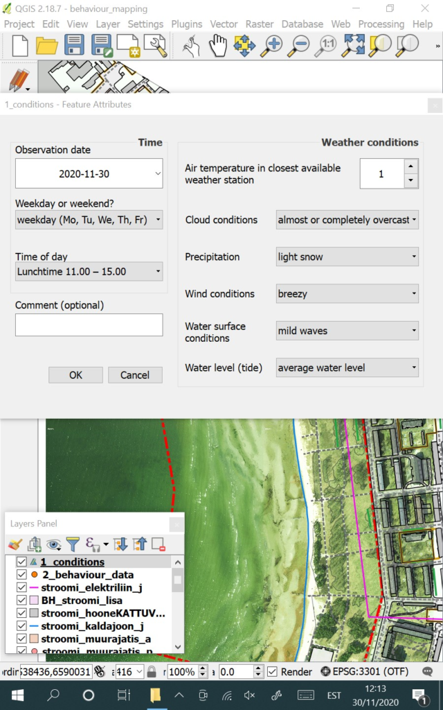
BBAT Screen 1 for Meta Data and Weather Condition
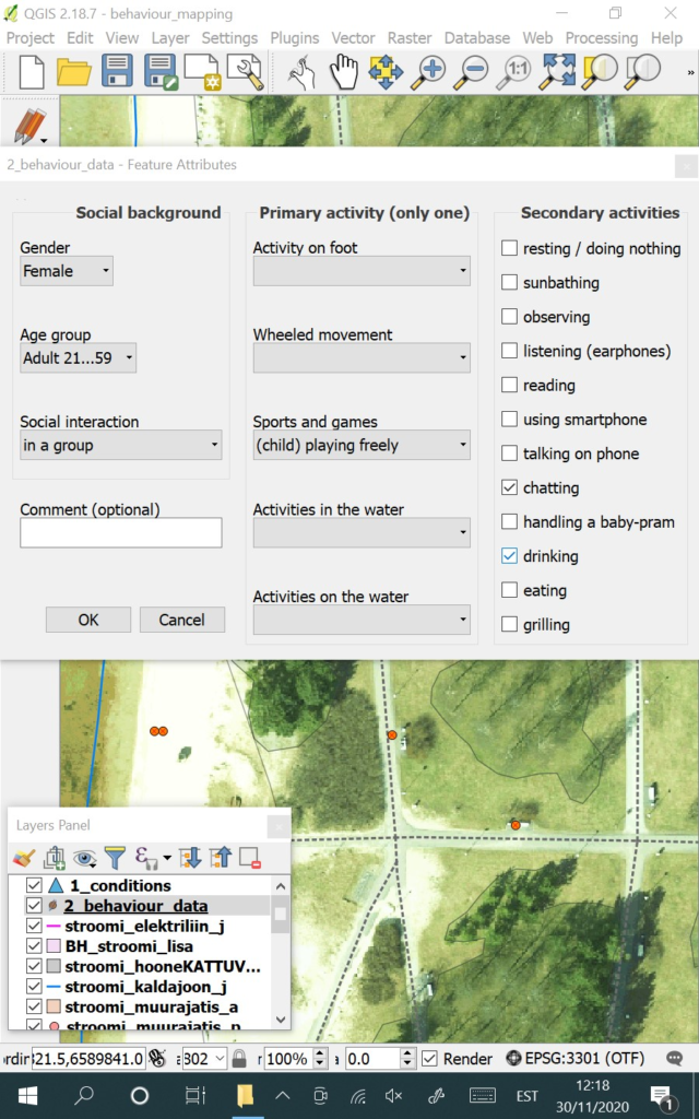
BBAT Screen 2 for Activities
When using the Tool please include the following reference:
Bell, Simon; Mishra, Himansu Sekhar; Elliott, Lewis R.; Shellock, Rebecca; Vassiljev, Peeter; Porter, Miriam; Sydenham, Zoe; White, Mathew P. (2020). Urban Blue Acupuncture: A Protocol for Evaluating a Complex Landscape Design Intervention to Improve Health and Wellbeing in a Coastal Community. Sustainability, 12 (10), 4084.10.3390/su12104084.